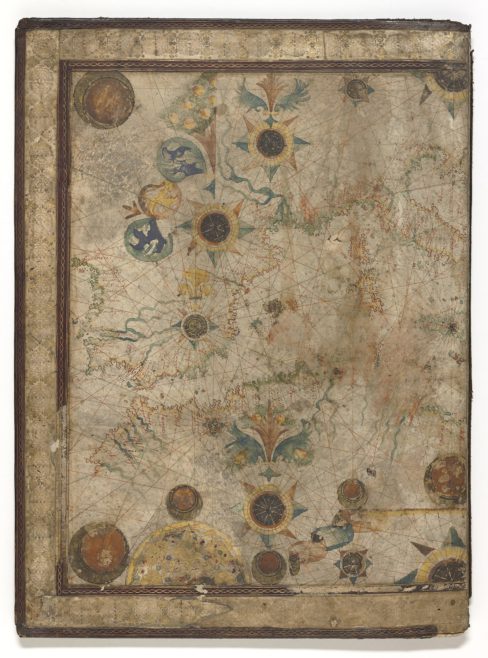

Portolan navigational charts or maps were created by medieval explorers in Europe sailing in the Mediterranean and along the Black Sea coasts. Engraved on sheepskin vellum the portolan map was a practical device used by mariners to navigate along ports, harbours and coastal shores. Since portolan maps did not consider the curvature of the earth they proved to be fairly unhelpful for sailing across the ocean.
Portolan maps were used by the Knights of the Order of St John in Malta and Rhodes. They served as a visual aid for directions and instructions given to sailors to ensure that there could be safe navigation for all ships crossing the seas. To avoid danger an important part of their function was to ensure that coastal place names were written on the land side of the coast to avoid confusing with courses marked on the sea. Significant ports were also transcribed in red ink while lesser ports appeared in black.
This half sea portolan map was made by Nicola il Board in Marseilles and depicts the western Mediterranean in 1673. The island of Malta is depicted on the map with the Order’s cross. This specific map was most likely created as a presentation copy to be given to a noble or merchant of Marseilles as the decorative borders are far more embellished than those usually presented on a mariner’s portolan chart.